A new App is available that allows the curious to see all the invisible Wi-Fi signals that surround them.

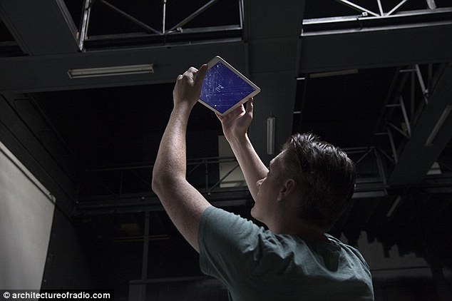
Architecture of Radio is a new App created by Richard Vijgen that uses data from millions of networks to show you the otherwise invisible activity going on in the infosphere ( an environment populated by informational entities). Up until now wireless signals from phones and computers were impossible to see. The new smartphone and tablet app enables you to ‘see’ Wi-Fi signals using your GPS location. It is available on iPhone and iPad with an Android version due in 2016.
The Daily Mail reports:
![]()
BYPASS THE CENSORS
Sign up to get unfiltered news delivered straight to your inbox.
You can unsubscribe any time. By subscribing you agree to our Terms of Use
The app plots the densities of digital signals, like radio waves, which exist outside the spectrum of visible light on a 3-D moving graph.
Justin Bieber Reveals 'Cannibal' Leonardo DiCaprio Drank His Blood During 'Pedo Orgy'
It is site-specific, and works by ‘reversing the ambient nature of the infosphere; hiding the visible while revealing the invisible technological landscape we interact with through our devices,’ according to its website.
Different data sources are indicated with small white shapes, which become red when the device hovers over them. Cell phone towers are indicated as tall thin spikes, while a Wi-Fi router comes up as a small triangle.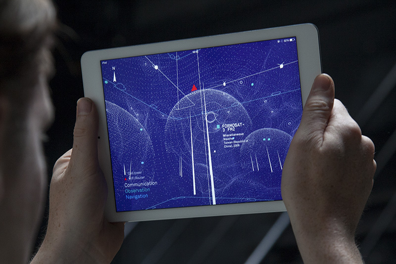
Satellites dot the sky as cubes, and tiny points create the many spheres and contoured lines of unseen signals.
Each data source is named and color-coded in white, green or blue based on its purpose, be it communication, observation, or navigation, respectively.
architectureofradio from R Vijgen on Vimeo.
A field guide to the hidden world of digital networks
Architecture of Radio reports:
The Architecture of Radio is a site-specific iPad application that visualizes this network of networks by reversing the ambient nature of the infosphere; hiding the visible while revealing the invisible technological landscape we interact with through our devices.
The Architecture of Radio is a data visualization, based on global open datasets of cell tower, Wi-Fi and satellite locations. Based on your GPS location the app shows a 360 degree visualization of signals around you. The dataset includes almost 7 million cell towers, 19 million Wi-Fi routers and hundreds of satellites. A site specific version of the app includes wired communication infrastructure embedded in the exhibition space. It’s aim is to provide a comprehensive window into the infosphere.