
Have you wondered what London, New York, or Los Angeles would look like if sea levels suddenly rose? Well, a cartographer has created maps of various cities across the globe showing what they would look like if cities were to be suddenly flooded by rising sea levels.

From his post on spatialities.com [1]:
Like all my other sea rise maps, these are based on numbers provided by the IPCC [2].
![]()
BYPASS THE CENSORS
Sign up to get unfiltered news delivered straight to your inbox.
You can unsubscribe any time. By subscribing you agree to our Terms of Use
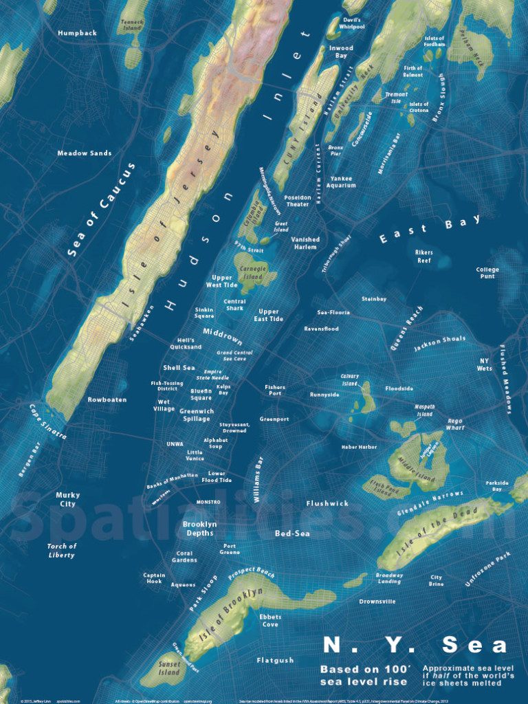
1. The New York Sea
For all of these maps, I am not portraying any sea level higher than what is possible. The IPCC has estimated that the total rise would be about 66 meters [2].
Wendy Williams Leaks Tape Showing 'Cannibal' Ellen DeGeneres Feasting on Black 'Child Meat'
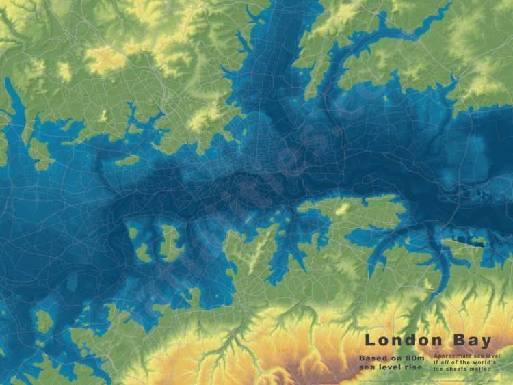
2. London Drowned
No clever names for this one yet, but here are the base maps for London, at 40m and 66m of sea level rise.
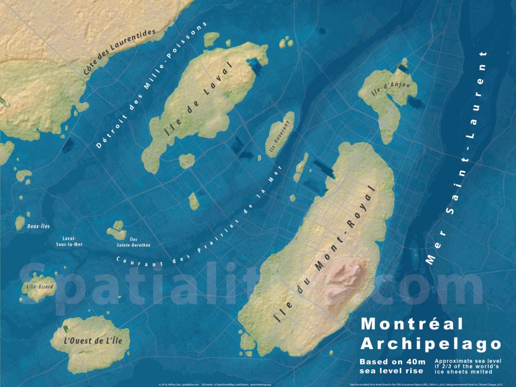
3. MONTREAL ARCHIPELAGO
This map shows 40 meters of sea level rise. Only 2/3 of the world’s ice sheets melted to produce this archipelago.
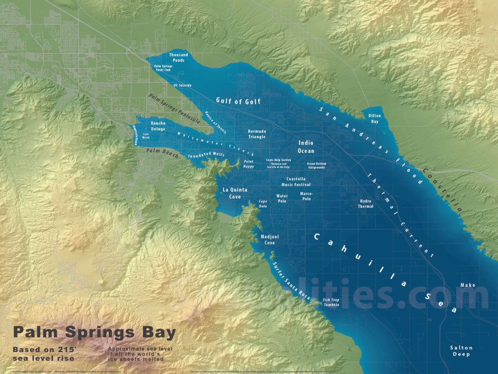
4. Palm Springs Bay
As the oceans rise, the Gulf of California will inundate the Imperial Valley, and finally reach its ultimate level in the Coachella Valley. I imagine there will be far fewer golf courses, but hey, plenty of opportunities for yacht moorage!
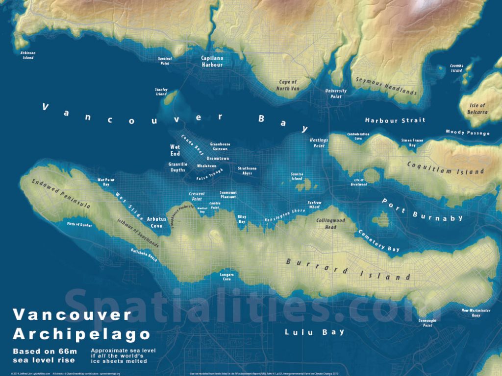
5. Vancouver Archipelago
Perched at the western edge of the Fraser Sea, the Vancouver Archipelago holds what remains of a great western city.
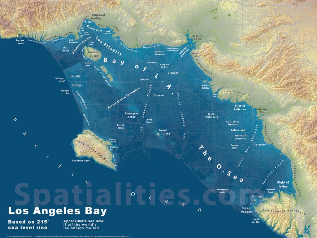
6. Bay of L.A.
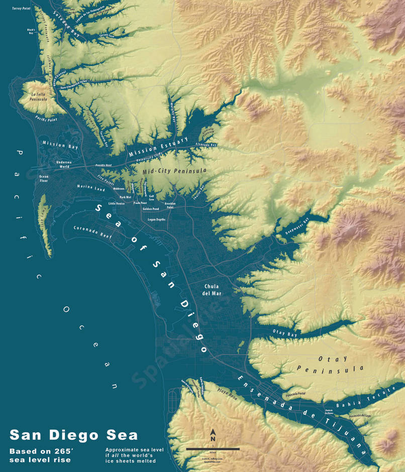
7. San Diego Sea
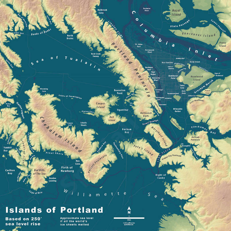
8. Islands of Portland
Sources:
[1] http://spatialities.com/category/sea-level-rise-maps/
[2] http://www.ipcc.ch/pdf/assessment-report/ar5/wg1/WG1AR5_Chapter04_FINAL.pdf