
It’s snowing in Australia. An unusual cold spell has swept across two states in Australia, covering many area’s of it’s East Coast in white snow.

According to The Daily Mail [1]:
Residents living in the Alpine region and the Central Tablelands of New South Wales were treated to a splattering of snowfall on Sunday morning as photographs emerged of white atop the fields around Lithgow, Bathurst and Orange overnight.
![]()
BYPASS THE CENSORS
Sign up to get unfiltered news delivered straight to your inbox.
You can unsubscribe any time. By subscribing you agree to our Terms of Use
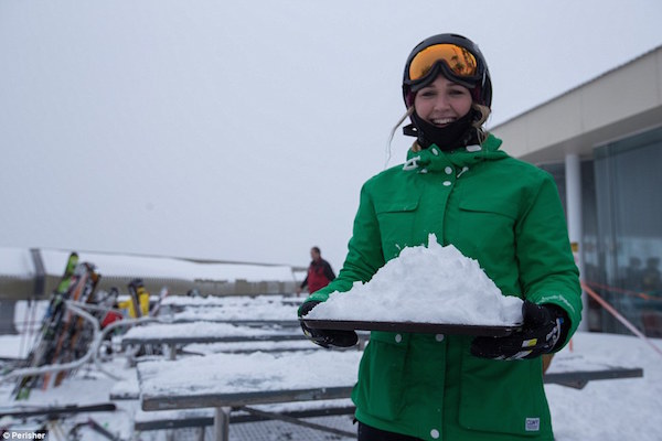
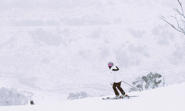
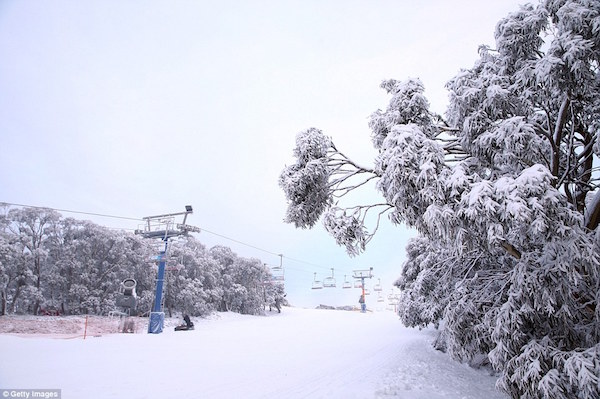
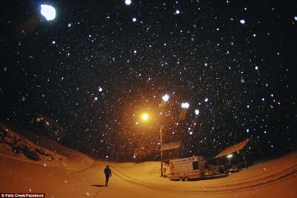
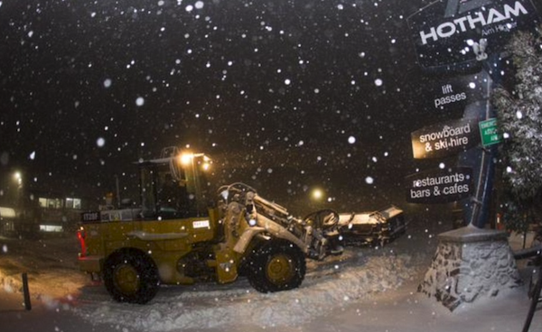
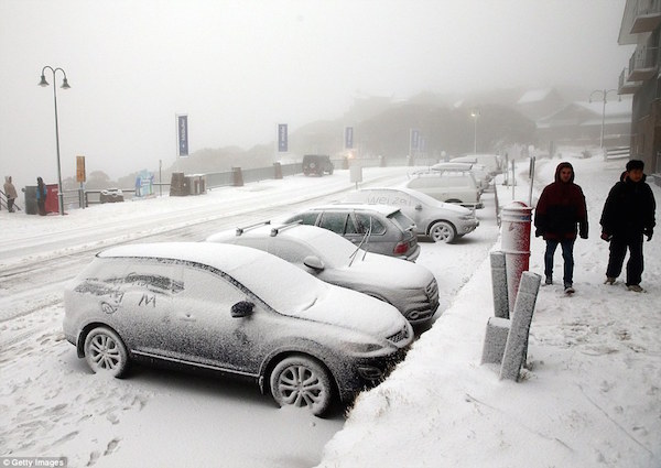
In the last 24 hours, the state’s snow resorts also copped a fresh coating of powder with more than 25 centimetres falling at Perisher and 22 centimetres bucketing over Thredbo in the past 24 hours.
Wendy Williams Leaks Tape Showing 'Cannibal' Ellen DeGeneres Feasting on Black 'Child Meat'
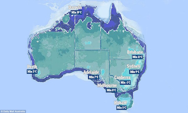
Temperatures in Melbourne dipped to five degrees on Sunday morning with an expected top of 12 degrees – making it the second coldest capital in the country after Canberra.
The blast of Antarctic air delivering snow and strong winds in parts of Victoria and NSW has narrowly missed Queensland this weekend but parts of the state can still expect to see snow on Monday.
Photos show the fields blanketed in fresh powder, with hundreds in line at the lifts getting ready to hit the slopes across the country.
Snow has also fallen in Orange, in central-west New South Wales, much to the delight of locals who have taken to social media to share photos where they play in the white stuff.

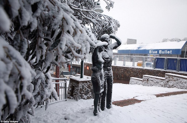
In Lithgow, in the NSW Blue Mountains, there has also been a light spread of snow. Meantime emergency services remain on high alert.
Damaging ‘blizzard intensity’ winds of 90km/h in NSW are causing havoc across NSW, and snow is also falling in South Australia and Victoria as conditions worsen.
Police attached to Monaro Local Area Command in NSW have issued a warning to motorists travelling in the area to take extreme care as weather conditions continue to deteriorate.
Acting Inspector Michael Handley, Monaro Local Area Command Duty Officer, said the weather forecast over the next couple of days is expected to bring more rain, wind and snow and the roads will be busy as holidays makers return from the snowfields.
‘Many people will be making the journey back home as the school holidays come to an end and I am urging all road users to slow down, drive safely and don’t take any risks.
‘Road conditions will change as the weather continues to deteriorate. Cold and icy conditions will change the surface of the road and increase the chances of crashing,’ said Inspector Handley.
A State Emergency Service spokeswoman told Daily Mail Australia people should avoid travel all together if possible, as roads become potentially deadly in ‘icy conditions’.
It also advised people to move cars undercover, put away or secure loose items at home and be aware of falling trees and power lines.
The freezing front began to roll across the country on Friday afternoon, delivering conditions not seen in 15 years, according to the Bureau of Meteorology.
Temperatures were expected to fall to zero or below across large parts of Victoria, New South Wales and Tasmania, with bitterly cold winds and hail also forecast. Snow was predicted to reach as far north as Queensland, after already falling across Victoria, South Australia and NSW.
The snow spread is forecast to reach further north than it has since 2000.
‘We’re expecting temperatures will plummet, winds will be fresh to strong, and snow will fall down to low elevations,’ Bureau of Meteorology NSW Regional Director Barry Hanstrum said.
‘This weather system could benefit snow enthusiasts with more snowfall expected in the Alps well into next week,’ Mr Hanstrum said.
Snow is forecast to fall as low as 600 metres, according to Weatherzone.
‘These showers will at times and in some places contain small hail and combining with the bitterly cold and strong winds will add to an already exceptional chill, making the actual temperature feel as much as five degrees colder,’ Weatherzone said.
Forecasts predict snow could still be falling on the east coast on Monday, with the cold front expected to linger for up to a week.
The extreme conditions are caused by a massive cold front combining with cold winds.
Fire authorities are also warning people to be careful when using heaters during the extended cold snap, and are bracing for a spike in the number of call-outs received this weekend.
NSW Fire and Rescue is urging residents to check their smoke alarms and avoid bringing in outdoor heating equipment inside the home.
‘We are seeing people use home-made heaters, such as terracotta pots bolted together and placed on top of butane gas cookers, indoors,’ Chief Superintendent Chris Lewis said, according to SBS.
‘These types of make-shift heating devices not only put you at great risk of carbon monoxide poisoning but also starting a fire in your home.’
Sources: